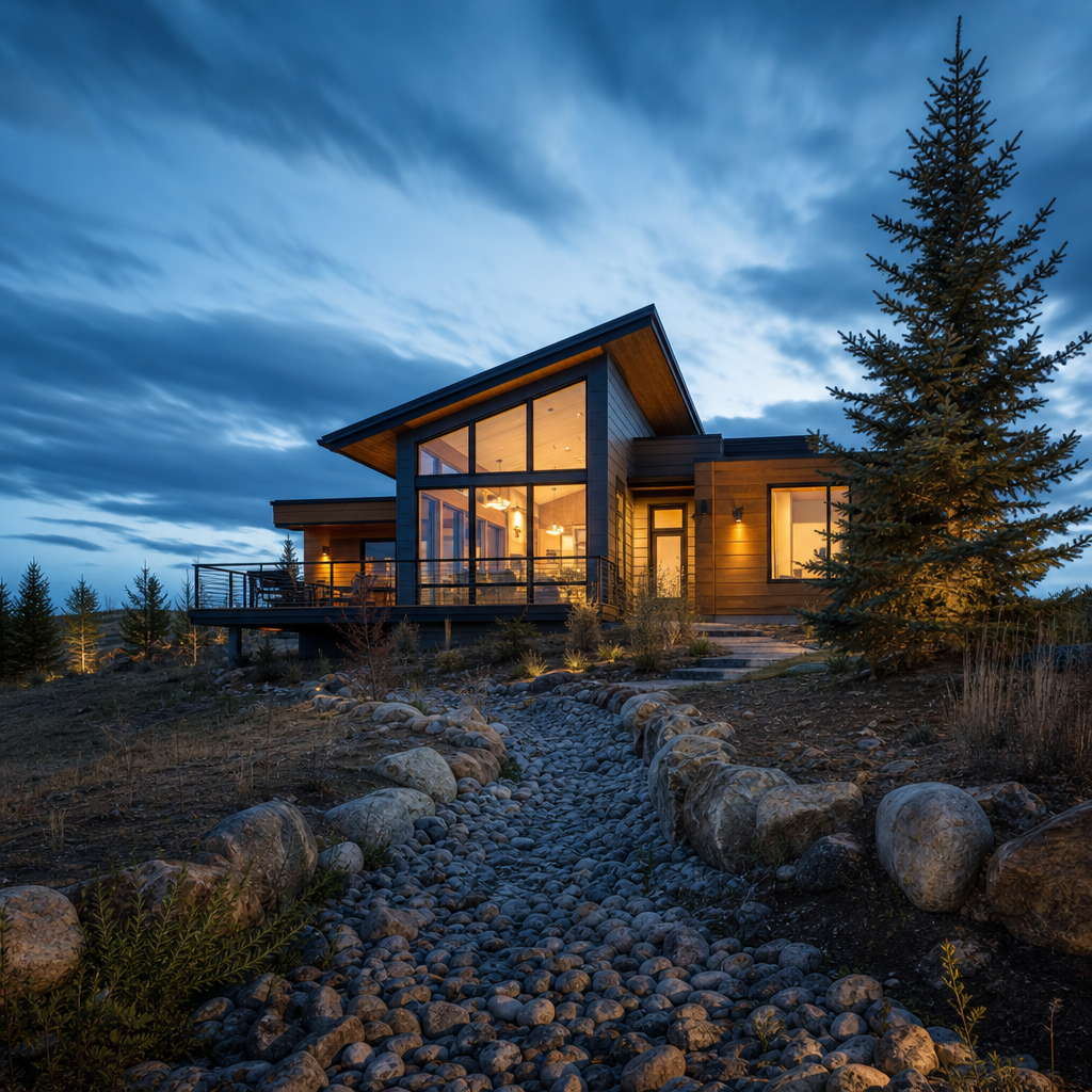
Persistent ground moisture and improper drainage are key drivers of foundation issues and municipal redlines in Alberta residential construction. Meticulous integration of Alberta Building Code requirements and municipal bylaws into permit drawings, advanced grading dimensioning protocols, and fully annotated swale details are essential to receive permit approval and achieve field performance.
ABC and Municipal By-Law Requirements for Residential Site Drainage Documentation
Code and Bylaw Mandates for Grading and Lot Drainage
Section 9.14.3.1 of the Alberta Building Code (ABC) states, "The ground immediately adjacent to the building foundation shall be graded to provide a minimum slope of 10% away from the building for at least 2 m from the foundation wall." The ABC further prescribes in 9.14.3.2 that foundation drainage systems require a 100 mm minimum diameter drain tile or pipe, installed below the floor slab on undisturbed or well-compacted soil and covered by at least 150 mm of granular material (see also ABC 9.14.3.3, Installation).
Municipal lot grading bylaws such as City of Calgary Bylaw 25M95 and City of Edmonton Bylaw 18093 enforce similar or stricter requirements. For instance, Calgary's bylaw mandates an As-Constructed Grade Certificate within 12 months post-occupancy, verifying as-built grade tolerance and positive drainage to approved discharge locations. Edmonton's bylaw requires all "surface water runoff be directed away from buildings, toward city right-of-ways and designated drainage features." These bylaws are enforceable at the permit stage, with repeated deficiencies resulting in delayed occupancy or stop orders.
Integrating Regulatory Requirements onto Permit Drawings and General Notes
Site Plans must indicate:
- Proposed and existing grades at set intervals, especially along property lines, at all building corners, and at mid-points of complex site geometries.
- Drainage swale centerlines, flow arrows, and proposed invert elevations.
- Grade breaks, property line setbacks, window wells, walkouts, and any intersection with utility crossings.
Grading Plans require:
- Explicit slopes away from foundation walls, 2% minimum (20 mm/1000 mm) for landscape adjacent areas, or 10% over first 2 m (200 mm drop)-as per ABC 9.14.3.1 and City of Calgary.
- Swale longitudinal slopes, typically 1.5-2.0% for turf (non-concrete) swales, bottom widths, and cross-sectional dimensions.
- Clear distinction between existing and proposed contours (using dashed and solid lines, respectively).
General Notes Sheets are where code and bylaw references appear for compliance clarity. Each note should be directly cross-referenced on the grading or site plan. For example:
- "ALL GRADING AND DRAINAGE TO COMPLY WITH ABC SECTION 9.14.3.1 AND CALGARY LOT GRADING BYLAW 25M95, ENSURING POSITIVE SURFACE DRAINAGE AWAY FROM ALL DOTS TO MUNICIPAL RIGHT-OF-WAY."
- "FOUNDATION DRAINAGE PIPE TO BE 100 MM DIA. PERFORATED PVC TO ASTM C4, 150 MM MIN. WASHED GRAVEL CELLED, ABC 9.14.3.1, TYP."
Overlapping provincial and municipal requirements are best synthesized on the drawing in a Site Drainage Notes block and reiterated in typical detail references (e.g., A-DS-09, see below). Sufficient context in notes allows municipal plan reviewers to verify compliance without RFI cycles or redlines.
Standard Drawing Conventions, Swale Details, and Real Plan Redlines
Accurate site drainage plans go beyond symbolic fence lines or vague slope callouts. Swale cross-sections must be provided, annotated for all dimensions, slopes, topsoil and compacted base thickness, and turf specification. For example, Edmonton lot grading reviewers frequently redline:
- "Grading does not meet minimum 2% slope at property line. Revise to comply with Bylaw 18093 and provide cross-section with proposed slope and stabilization."
- "Drainage pipe material not specified. Detail to ABC 9.14.3.1 with reference to ASTM C4/CSA B182.1."
- "Missing swale section detail. Provide minimum 1.0m bottom width, 150 mm topsoil, 95% SPD compacted subgrade."
Setbacks-such as swale edge to lot line or foundation wall-are to be clearly dimensioned, with each tie-in annotated and cross-referenced to section cuts or enlarged detail sheets. Use the following conventions:
- Ditch centerline = dash-dot line;
- Flow arrows = solid black with labeled slope, e.g., "1.5% SLOPE";
- Swale cross-section reference = callout bubble, e.g., "SEE A-DS-09."
Advanced Dimensioning and Spot Elevation Strategies for Code-Compliant Grading Plans
Spot Elevation Protocols: Finished, Natural, and Critical Elevation Documentation
Grading plan accuracy in Alberta hinges on systematic spot elevation placement and strategic dimensioning. Mandatory minimums for spot elevations include:
- All building (foundation) corners-both top of footing and finished grade;
- Property corners (both existing and proposed grades);
- Grade breaks (especially at wall projections, decks, walkouts, patios);
- Swale inverts at regular intervals (at least at every change of direction, inter-lot transition, driveway crossing);
- Utility crossing points and service entry trenches;
- Midpoints along side yards, where swale slope or invert may vary;
- Design datum or benchmark location, with full elevation string (e.g., "BM = HYDRANT NE CORNER, EL. 103.42 GEODETIC")
Code-mandated slopes and drainage patterns must be dimensioned in the first 2 m from the building perimeter (10% or 200 mm drop)-as per NBC(AE) 9.14.3.1. For areas further from the foundation, municipal standards typically require 2% minimum for turf (1.5% if concrete), explicitly dimensioned as "2.0% SLOPE FOR 5.0m TYP." or "L=5.00m, ΔEL=0.10m" in both plan note and cross-section callout.
Dimensioning and Flow Path Representation: Swale Widths, Slopes, and Datum
Best practice combines:
- Spot elevations labeled "E:" for existing, "P:" for proposed, e.g., E:110.44; P:110.22
- Slope percentage or ratio labeling, e.g., "SLOPE = 2.0% (1:50)" directly along flow path arrows;
- Explicit dimensioning of swale bottom widths (min. 1.0 m) and depths (typ. 150-200 mm) in both plan and section (with cross-section noted "SEE A-DS-09");
- Annotated swale inverts at daylight points, with proposed geodetic elevation and tie-in to existing grade;
- Flow arrows pointing away from structures, never toward window wells or walkouts, with registration to the site datum;
- Project datum reference: Often Top of Foundation (TOF = 100.00 or local geodetic), with all elevations tied to this baseline for field “cut-sheet” accuracy.
Plan reviewers commonly issue:
- “Provide existing and proposed spot elevations at all property corners and midpoints. Datum unclear.”
- “Sectional grades do not match plan. Revise for datum consistency across all sheets.”
- “Include flow arrows and explicit swale cross-section dimensions at all drainage features crossing lot lines.”
Specific Dimensions, Slope Callouts, and Material Documentation
Swale and grading standards, as referenced in Kingsway Drafting sample details, set these baselines:
- Swale bottom width = 1.0 m minimum;
- Swale depth = 150-200 mm beyond finished contour (not including topsoil);
- Side slopes = no steeper than 3:1 (preferably 4:1 in mowed turf zones);
- Topsoil = minimum 150 mm depth, per municipal landscape standard;
- Subgrade compaction = 95% Standard Proctor Density (SPD) for all swale and general landscaped backfill;
- Downspout extensions = 2.0 m away from foundation, daylighting to swale invert or concrete splash pad;
For full field accuracy, all spot elevations must be confirmed from a clearly noted benchmark, tied either to geodetic (municipal supplied) or to a permanent on-site feature (hydrant, utility riser, etc.). “All elevations referenced to BM as noted; site datum = 100.00 TOF unless otherwise specified.”
Detailed Design and Annotation of Drainage Swale Cross-Sections and Termination Points
Swale Profile Selection and Cross-Sectional Notation
Three primary drainage swale profiles serve Alberta residential lots: trapezoidal, parabolic, and V-shaped. Trapezoidal swales are most common for residential (“bottom width 1.0-1.2m, side slopes 3:1, depth to invert 150-200mm”) as per City of Edmonton guidelines. Parabolic profiles may be used for wider inter-lot swales with shallow slopes and aesthetic requirements; V-ditches are reserved for narrow lots or rear lanes, with concrete or riprap lining specified to address velocity and erosion (see Calichi Swale Design reference).
Each cross-section should display:
- Bottom width, invert elevation, and side slope ratio dimensioned;
- Subgrade compaction note, e.g., “COMPACT SUBGRADE TO 95% SPD, MIN.”;
- Topsoil thickness and turf (or erosion mat/riprap) callouts;
- Label of adjacent grade break (e.g., “TIE TO EXIST. GRADE EL. 112.08 AT LOT LINE”);
- Reference to detail sheet, e.g., “SEE DETAIL A-DS-15 FOR TYP. PARABOLIC SWALE SECTION.”
Material Call-Outs and Specified Layers
The minimum section, as summarized from City of Calgary and Kingsway practice, includes:
- Topsoil: 150 mm, “PLACE MIN. 150mm TOPSOIL, SODDED OR SEEDED.”
- Subgrade: “COMPACTED TO 95% STANDARD PROCTOR DENSITY, FREE OF DEBRIS.”
- Erosion protection: For swales >2.5%, “PROVIDE RIPRAP 75-150mm DIA. AT TERMINATION, OR TRM PER CIVIL ENG. DETAIL.”
Driveway crossings require reinforced concrete swale sections (“120mm min. thick, 32 MPa, c/w welded wire mesh, continuous expansion joints at each edge”), with slope and width maintained through the crossing and detailed on both plan and section sheets.
Graphically Representing Termination Points and Inter-Lot Integration
Swale terminations may daylight, discharge to catch basins, or transition to municipal storm. Each must be fully detailed, including:
- Daylighting: “TYP. SWALE TERMINATES AT EX. GRADE EL. 110.21, OUTFALL STABILIZED WITH RIPRAP PAD (MIN. 1.2x1.2 m), SEE A-DS-22.”
- Connection to municipal storm: “CONNECT SWALE TO CB #1142 W/ AREA DRAIN, INVERT EL. 109.62 GEODETIC, C/W INLET PROTECTION.”
- Inter-lot drainage: Shared swales at property lines must be annotated, “SHARED SWALE EASEMENT, SEE REG’D ENCUMBRANCE #88-12342; MAINTENANCE BY BOTH OWNERS.”
Detail sheet references must be coordinated between plan, section, and detail callouts so that both municipality and jobsite have a single source of truth: e.g., “SEE DETAIL A-DS-15 (TRAPEZOIDAL SWALE TYP.), A-DS-18 (PROPERTY LINE EASEMENT SWALE), A-DS-21 (SWALE-RETAINING WALL INTERFACE), A-DS-22 (SWALE DAYLIGHT TERMINATION).”
Field inspection often generates comments such as, “Provide additional elevation data at property line swale intersection. Stabilize daylight outlet with specified erosion control mat or riprap per detail.”
Anticipating and Addressing Common Plan Review Redlines for Residential Drainage Submissions
Frequent Drainage Plan Deficiencies and Reviewer Redlines
Plan approvers across Alberta consistently flag the following:
- Inadequate spot elevation density: “Add elevations at all property corners, midpoint, and critical swale transitions to verify positive drainage.”
- Unclear positive flow paths: “Slope direction ambiguous-add labeled arrows and explicit min. slopes throughout.”
- Non-compliant minimum slopes: “Section at rear yard does not achieve 2% grade minimum, per bylaw. Revise proposed contours.”
- Missing inter-lot drainage agreement annotations: “Show on plan and submit copy of inter-lot agreement for maintenance responsibility and access.”
- Insufficient detail for swale termination: “Show termination detail, stabilize any daylight outfall, and reference section.”
- Inconsistent datum between plan and sections: “Datum reference changes between plan and section - must be consistent site-wide.”
- Plan/section discrepancies: “Cross-section elevations do not match those on grading plan. Reconcile and revise.”
Best Practices to Proactively Address Common Redlines
- Embed spot elevations at every break in grade, all property corners, swale inverts, walkout or step features, and any utility conflict point.
- On every drainage path, display flow arrow, direction, labeled percent slope (“2.0% MIN. TYP.”), and finished floor vs. surrounding grade for all entry thresholds.
- Coordinate datum/benchmark between all drawing sheets; note clearly: “BENCHMARK = EXIST. C/G @ STA. 1+46, EL. 110.94m; ALL ELEVATIONS REFERENCED TO THIS DATUM.”
- Always include detail call-outs for all swale transitions (to property lines, driveways, retaining structures, and terminations), with referenced sheet and detail symbol.
- Attach or reference shared drainage agreements for municipal review (typical for duplex/inter-lot swales or mid-lot grading breaks).
- For each major grading area, cross-reference plan view to corresponding section cut with section line and bubbles, and match the callout elevations.
Clear notation in title blocks and legend, with codes as follows:
- E: = Existing elevation (spot or contour)
- P: = Proposed elevation
- TOF = Top of Foundation
- GC = Garage Slab
- W/W = Window Well
Always annotate and sequence grading notes:
- “Field confirm all existing elevations and benchmarks prior to start of work.”
- “All surface grades must achieve minimum 200 mm drop over first 2 m away from foundation (10% slope), per NBC(AE) 9.14.3.1.”
- “Swale longitudinal slope minimum 1.5%; bottom width min. 1.0m, side slopes not steeper than 3:1; see Detail A-DS-15.”
- “All compaction to 95% SPD; subgrade inspected prior to topsoil placement.”
- “All deviations from proposed must be documented by site superintendent and communicated for plan revision before grading inspection.”
Construction-Phase Documentation and Jobsite Coordination for Designed Drainage Implementation
Critical Drawing Information for Excavators, Graders, and Field Teams
Field crews rely on precise benchmarks and workable grading documentation. Field benchmarks, as labeled on permit plans, must be physically set and marked on site ("BM = FIRE HYDRANT 10.2 m S OF NW CORNER, EL. 111.44"). All proposed contours (solid lines), with grade break dimensions, must be dimensioned relative to the benchmark and checked for field accuracy prior to site grading commencement.
Key grading information required:
- Plan and section showing all elevation ties-building corners, walkouts, garage slab, property line, and swale inverts.
- Spot elevations labeled P: and E:, called out at each change in surface type (asphalt, turf, concrete pad, etc.).
- Dimensions for all grade breaks (distance from building to slope transition, swale invert to property line, etc.).
- Material thicknesses (e.g., backfill and topsoil), and compaction requirements.
Common RFI Scenarios and Field Adjustments
Jobsite queries most frequently arise due to:
- Elevation discrepancies between design and actual site-for these, “RFI-17: Clarify intended grade at northeast property corner; unanticipated fill conditions encountered, proposed P:112.22 EL unachievable without exceeding 3:1 slope.”
- Clearance issues for window wells, walkouts, or immediately adjacent concrete pads-“RFI-22: Request alternate swale profile to maintain 200 mm drop from walkout threshold within sideyard setback.”
- Requests for material substitution, e.g., “Propose alternative compaction method due to saturated soils, please confirm acceptability.”
All field adjustments must be documented:
- Mark up original drawings “as-built,” highlighting deviation and cross-referencing official plan revision if later formalized;
- Photodocument field condition and adjustment for record and inspection;
- Note rationale (“Unforeseen boulder at P:112.14; swale relocated 600 mm north, invert adjusted to P:112.02”);
- Update datum/elevation data and tie adjusted feature back to project benchmark.
Compaction, Material Inspection, and Grading Verification Protocols
- Compaction-Test backfill prior to topsoil placement ("compaction to not less than 95% SPD, test results to site superintendent and included with final grading certificate").
- Material Specification-Site superintendent must verify that all drainage pipe, filter fabric, and erosion control materials match stamped permit plan specifications, including manufacturer’s data and delivery slips retained.
- Final Grading Inspection-Hold on-site walkdown with As-Constructed Grade Certificate (as mandated by City of Calgary Bylaw 25M95). Surveyor must shoot all property corners, swale inverts, and major grade breaks, referencing plan benchmark.
Municipal inspectors require certification stamped by engineer or surveyor that “all proposed grading conforms to approved permit plan and achieves positive drainage to municipal system, with 200 mm drop at foundation and all swales constructed per detail A-DS-15/18.”
Drawing Conventions and As-Built Deliverables
- Maintain color or symbol distinction between “as-proposed” (solid lines/spots) and “as-built” (dashed lines or triangle symbols);
- Keep a running document log of all RFIs, adjustments, and formal field changes; file with permit record upon project closeout;
- Use photodocumentation (“View SW from NE corner, post-topsoil, 2% slope verified with laser level") in reporting package;
- Submit all final elevations referenced to project benchmark with full explanation of any deviations and corrective actions taken.
Standard call-outs for field sheets include:
- "BM = HYDRANT NE CORNER, EL. 110.22 GEODETIC. TIE ALL CUT/FILL TO BM."
- "PROPOSED SWALE: BOTTOM EL. P:109.88 TYP. (SEE A-DS-15)."
- "MIN. SLOPE 2.0% TO DAYLIGHT @ PROP. LINE INVERT P:109.72."
Conclusion
Dimensioning and detailing drainage swales and flow paths on Alberta residential permit plans is a rigorous, detail-driven process, demanding integration of ABC 9.14 code, local bylaws, precise dimensioning protocols, fully annotated cross-sections, and clear construction-phase workflows. From permit plan submission through as-built verification, discipline in documentation and coordination ensures both compliance and performance. Kingsway Drafting & Design delivers site drainage and grading details that stand up to scrutiny, from permit desk to final inspection.